WUNRN
https://www.google.com/?gws_rd=ssl#q=Flooding+in+Myanmar+-Photos
MYANMAR/BURMA – FLOODS INUNDATE OVER 20 VILLAGES – FOR
WOMEN, SURVIVAL RISKS & DESTRUCTION OF HOMES, LAND, CROPS
Chiang Mai (Mizzima) – Over 20 villages in Kawa Township, Bago Region, were
inundated after the Bago River spilled over its banks, threatening rice
production in the area.
Incessant heavy rain over a five-day period has led to flooding in villages
including Neikban, Pai Kyone, Taunggyi, Na Be Pin, Moe Khaing, Kyar Tet, Kamar
Pale and others. The flood inundated many paddy fields in the area.
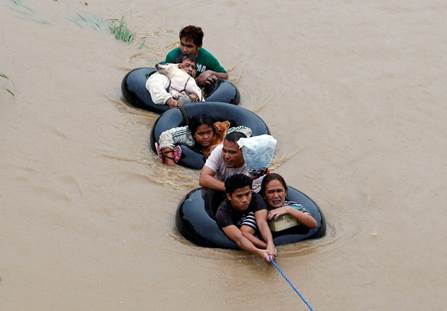
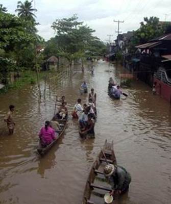
On Wednesday, residents in some villages had to use boats for transportation.
‘The nursery of our paddy will be spoiled if rain continues three more days’,
said a farmer in Kamar Pale village whose 12 acres of paddy were underwater.
In the recent bean growing season, many bean and pulse farmers in Bago Region
lost their crops due to bad weather. Now these same farmers are in danger of
losing their rice crops.
‘If we have to grow the paddy nursery again, we will have to be indebted
again’, a farmer said, eyeing his uncertain future.
The flood in the Bago River was the worse since 2000, residents said. The river
is about 200 feet across in many areas, with a depth of about 15 feet.
A factor in the flooding is the uncontrolled logging in the Bago mountain range
which has increased the likelihood of flooding in the area, said
environmentalist U Ohn of the Forest Resource Environment Development and
Conservation Association.
‘In the past, the Bago mountain range could hold and conserve water. Now the
watershed and catchment area has been depleted due to over logging and it could
not control the flood. Later, the Bago city will be flooded.
‘To conserve forest and water, there must be trees and forest, at least there
must be grass and bushes. In this way water flow can be controlled and
conserved. This is one of the consequences of destroying our environment’, U
Ohn told Mizzima.
According to a report issued by the Myanmar Forest Department, forest area in
Burma now accounts for about 42 per cent of the land. Forests are being rapidly
depleted in the upper Burma region of Shan, Kachin and Chin States and Magwe,
Sagaing and Mandalay regions by logging and cutting for firewood.
Mangrove forests in Mon, Rakhine, Tanintharyi and Irrawaddy regions have also
been depleted by uncontrolled logging and charcoal production.